


|
Getting your Trinity Audio player ready...
|
This story is republished from our partners at NOTUS.
The people of Key West, Florida, are living with flood maps based on studies that are more than 30 years old. So, too, are some of the people in the rural counties of Latimer and Pushmataha, Oklahoma. East Carroll Parish, Louisiana. Chautauqua, New York.
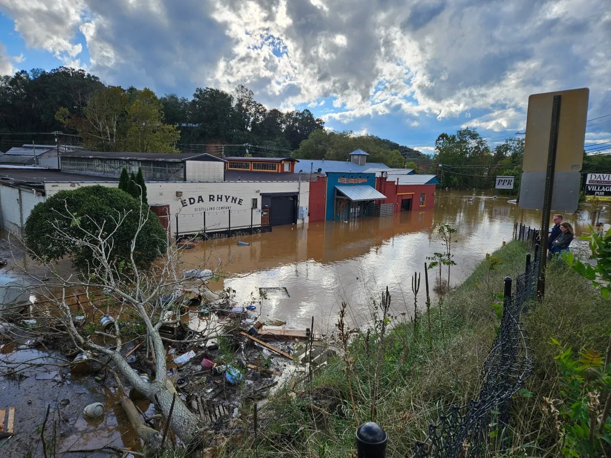
In Buncombe, Yancey, Avery, and Burke counties in western North Carolina, where flooding in the aftermath of Hurricane Helene devastated communities, the most recent maps date back to anywhere from 2007-2010.
Many of the maps that dictate the country’s flood zones—and decide who has to buy flood insurance—are significantly outdated. Efforts to change them, however, keep hitting a roadblock: the people who live there.
The nation’s deadliest floods put the crisis in clearer focus: In the Texas Hill Country, certain buildings on the grounds of Camp Mystic, where young campers died in the July floods, had received amendments to be excluded from the Federal Emergency Management Agency’s updated maps.
There are buildings, neighborhoods and entire cities just like Camp Mystic throughout the United States. Local governments, like that of Key West, Florida, with the aid of private engineering firms and lawyers, have fought hard against updates to maps that show more of their residents living in high-risk zones, or that will make it harder to build and turn over real estate.
“The common response is: ‘Why are you putting a flood plain on me? I don’t want you to put a flood plain on me,’” said Glenn Heistand, a University of Illinois water resources engineer who leads FEMA flood mapping updates for the state of Illinois.
Flood maps don’t only warn communities about their risks. They come with a “regulatory burden,” he said. “It may devalue their home, it may make it harder for them to sell, it may cause them to have to purchase flood insurance.”
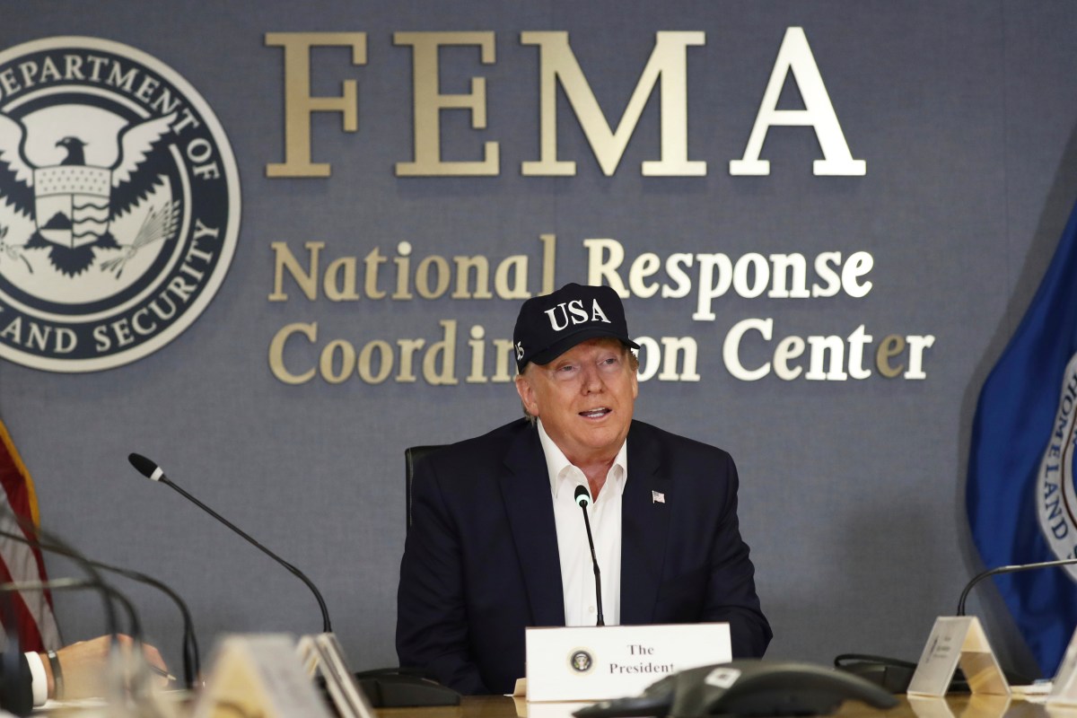
FEMA, increasingly under-resourced, hasn’t always been able to adjudicate these conflicts in a timely manner. The Trump administration has acknowledged the problem, while also cutting about a quarter of the agency’s staff. FEMA’s flood mapping processes and the National Flood Insurance Program are “a priority area for review,” the agency told NOTUS.
“There are unfortunately events that occur when maps are in the process of being adopted, where…damage might have been avoided.”
David Maurstad, former FEMA official
The stakes are high for the more than 22,600 communities that have opted into the federal flood maps program. Updated maps give residents a better understanding of the danger they face—and require communities to set building codes based on flood risks. They can also create perverse incentives, and ill will can grow quickly.
“The maps themselves are inherently political, whether you want to admit it or not,” said Karl Bursa, the public works manager for Lake County, Florida, and former floodplain manager for Monroe County, Florida, which governs the Florida Keys.
Without accurate maps, Americans are left to contend with the harsh realities of a changing climate, chronically under-insured and without adequate information about the risks they face.
Insurance Costs
Congress requires that the federal government review the national flood maps every five years. But the government can rarely stick to that schedule.
FEMA has always been notoriously slow, and it is now facing staffing cuts and existential uncertainty under the Trump administration. And when the agency does change a map, communities will frequently appeal the update.
Participation in the flood mapping and in the National Flood Insurance Program is voluntary, and participants have the right to review and appeal FEMA’s decisions.
In return, communities must certify the final maps and follow federal regulations about what can be built inside the floodplain. If they don’t certify the new maps, they lose access to the nation’s subsidized flood insurance program.
The taxpayer-subsidized National Flood Insurance Program is currently covering more than 4.7 million insurance policies across the country—and the rates are set based on FEMA’s mapping. Researchers estimate that among those living in areas at risk for flooding, 88% are underinsured, both within and outside of FEMA’s mapped zones, according to an August paper published in Nature Climate Change.
“There are unfortunately events that occur when maps are in the process of being adopted, where if those maps had been adopted, damage might have been avoided,” said David Maurstad, who was the senior career official in charge of the National Flood Insurance Program before he left FEMA in July 2024. “But again, it’s more of a system issue than a FEMA issue that the maps can’t get adopted. Individuals are going to look out for their best interests, and some individuals think their best interest is these maps not being put in place.”
“The flood mapping process is a collaborative effort between FEMA, states, and communities. While FEMA is required to review flood maps every five years, updates are not mandated on that same schedule. Instead, FEMA works with state and local partners in each region to identify areas that need updates, prioritize resources, and incorporate community input. Local knowledge, areas of concern, and relevant data sources are integrated into mapping studies to ensure maps are accurate and useful,” the agency said in response to questions from NOTUS.
Flood insurance prices have been rising dramatically since FEMA began a restructuring of the NFIP in 2021 to make the cost of insurance more accurately reflect risks. The program had drawn repeated censure from the Government Accountability Office for its fiscal irresponsibility. The riskiest areas, like coastal zones in Louisiana and Florida, saw some of the steepest increases in price as a result of the reform, and in many high-risk areas, premiums have more than doubled since 2020.
“The maps themselves are inherently political, whether you want to admit it or not.”
Karl Bursa, public works manager for Lake County, Florida
And local governments dealing with economic uncertainty, housing shortages and trying to revitalize their cities don’t want to face additional burdens to develop.
“I believe in having good floodplain policy, the rationale for it makes sense, it’s a public safety issue. But the burden of making sure it’s accurate should fall on the people charged with implementing the program. It’s their obligation to make sure it’s right, and I don’t see a culture of ensuring it’s right,” Mequon, Wisconsin, Mayor Andrew Nerbun said.
Nerbun says the city’s new flood maps—which went into effect in 2024—dramatically overestimate the risks and are based on outdated data.
The new flood maps required residents who’ve been living in the city for decades to buy flood insurance for the first time. Milwaukee has been battling record flooding this summer, but Mequon has mostly been spared the devastation facing its neighboring city.
Even though the appeal period for Mequon ended last year, the city hired a private engineering firm to help it conduct a study to file a formal request for the map to change. Nerbun said that the new maps don’t incorporate data from a U.S. Geological Survey water gauge, which he said paints a lower flood risk picture than the one on the current maps.
“The process is rigged,” Nerbun said. “We’re a small community, relatively, 25,000 people. We don’t have certified floodplain modeling experts on our staff, and we were not in a good position to challenge at that time.”
Nerbun said that he believes FEMA doesn’t want to admit a mistake and wants more homeowners to pay for flood insurance to prop up the struggling finances of the NFIP.
“No one wants to dig up old skeletons on what may have been done incorrectly,” he said. “There’s a vested interest in this, because then they can charge more insurance,” he added later.
In neighboring Illinois, frustrations with FEMA’s mapping process are rooted in a desire to redevelop South Beloit. The city’s government believes that FEMA’s proposed map changes are dramatizing the flood risks, and they are pushing hard to get changes made before the maps are actually completed.
“The city has been fighting for five or six years to get this hotel torn down. We finally get it torn down, and we have at least one developer who has expressed an interest. And now nobody wants to lift a finger until we can get some sort of clarity from FEMA,” City Council member Courtney Prentice told NOTUS.
“We don’t have political clout. We don’t have lobbyists. We’re a small town.”
The Appeals Process
The National Weather Service issued more than 1,400 flash flood warnings in July, the second-highest total in 40 years, according to an analysis from the National Oceanic and Atmospheric Administration.
Outdated maps mean taxpayer dollars are funding increasingly frequent and expensive flood recovery efforts for communities that weren’t prepared for increasingly devastating flooding.
“Clearly the things that we have been doing aren’t getting the job done,” Maurstad said. “It’s not as simple as just making the maps newer or spending more money on maps. This situation that we have now, in my view, is not having the outcomes that the country is looking for.”
Resistance to new maps is especially common in wealthier communities with greater resources, according to research from Sarah Pralle, a political science professor at Syracuse University who specializes in the politics of flood mapping.
Pralle’s research has found the appeals process usually results in buildings being removed from flood zones after FEMA releases preliminary maps, and that communities often seek the smallest flood zones possible because they are worried about insurance costs and the way that floodplains affect future development.
“We don’t have political clout. We don’t have lobbyists. We’re a small town.”
Courtney Prentice, city council member in South Beloit, Illinois
In 2019, FEMA tried to thoroughly update its flood mapping for the Florida Keys.
There’s little question that flood risks have changed in Key West. Between 1980 and 2015, the island recorded only three years with low-level flooding occurring in multiple months of the year. But between 2015 and 2023, with one exception, Key West has experienced low-level flooding in many months of every single year, according to data from the Key West office of the National Weather Service.
A FEMA analysis using 21st-century technology and modeling found that more than 2,000 existing buildings in the city of Key West alone were at risk of serious flooding—buildings not marked with any risk on the existing maps.
The maps declared that much of the old town center of Key West, long considered immune from flood risks, needed flood insurance.
The Monroe County government immediately protested the changes, submitting a robust formal appeal to FEMA in 2021 that prevented the new proposed maps from going into effect. The appeal from Monroe County asked to remove almost all of the city center of Key West from the areas required to buy flood insurance.
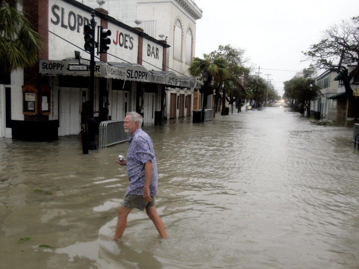
Since 2021, the county has not received an update on its mapping appeal. Until FEMA does address the appeal, which was conducted by a large international engineering and modeling firm that said it had access to newer and better data than FEMA, the people of the Florida Keys are allowed to go on living and building and buying like it’s 1997.
“The County communicates regularly with staff at FEMA and the State of Florida Division of Emergency Management’s Office of Floodplain Management to request updates on the timing,” said Emily Schemper, the growth management director for Monroe County, Florida. “At this time the County has not been provided an estimated timeframe,” she said.
“Staff continues to assist property owners, as much as possible, to plan ahead for the final maps in their permitting decisions and design of construction projects.”
FEMA did not respond to a request for comment about the status of Monroe County’s maps.
In Limbo
Mapping technology has radically changed since the first FEMA flood maps were created in the 1970s and 1980s. So has the physical landscape.
“Our understanding of the world, our understanding of science and how things are impacted, it’s a completely different animal now,” Bursa said.
He pointed to Florida specifically.
“We’ve been building like mad here. The developed environment compared to when they did the original mapping; it’s night and day. You’ve got areas that were completely wild, absolutely nobody lived there, and now all of a sudden you may have four or five different subdivisions within a 200-yard radius. That changes the character of the land, and it changes the character of the flooding.”
Keeping up with these aggressive changes requires significant reform to what the maps reflect and how they are used, not just better, faster-made ones, floodplain experts said.
“If we want a resilient nation, having good, accessible, granular risk information is a critical path.”
Victoria Salinas, former FEMA official
For about six years, beginning under the first Trump administration, FEMA was seriously exploring new or alternative ways to communicate risks and hazards so that people could actually understand them. Until Trump took office a second time.
Almost immediately, the Trump administration axed the independent group that has been pushing FEMA toward more significant changes—the Technical Mapping Advisory Council.
FEMA has since lost experts on flood mapping. Delays and cuts in contracting have slowed private sector and university work on mapping. And it’s not clear what FEMA has done with the Future of Flood Risk Data initiative, which most experts see as the leading effort to transform how flooding risks are communicated to the American public.
“If we want a resilient nation, having good, accessible, granular risk information is a critical path; we cannot get there without it,” said Victoria Salinas, who served as the deputy administrator for resilience at FEMA under the Biden administration. “That’s one of the key functions that’s been under attack both at FEMA and broadly, changes to the organizational structure to diminish and bury that work.”
Meanwhile, local governments are in limbo.
“We feel like an ant climbing a mountain,” said Prentice, the South Beloit city council member. “We’ve been grasping at straws to try to get people to listen.”
Anna Kramer is a reporter at NOTUS.